Cycling

Status
Not open for further replies.
I've been over to Sheffield a few times on the bike to see my family - through Bakewell, Baslow and up to Owler Bar. I've not done the Snake Pass but I've done the Cat and Fiddle between Macc and Buxton which is not too bad and Winnats Pass in Castleton the other week which was a reyt b*****d. 😱 There are lots of climbs not on the main roads of 15-20% + gradients in the Peak District which can be something of a test. I recently swapped the cassette on my rear wheel to give me a 'slightly easier' low gear - still hard work on the hills.

Winnats Pass on a cycle makes me feel dizzy.

I don't think people realise how long Snake Pass is, has to be one of the most

scenic routes in Blighty.
 
Another day off today so I took a ride back out into Cheshire. Swapped back to split Levemir last week so it would be the first test with that and things were remarkably steady. The weather was warm but mainly overcast although the sun came through on occasions. The glorious smell of the countryside - yes, the farmers were muck spreading :D although some were grass cutting. I just had bibshorts and short sleeved jersey on but I saw one rider in bibtights and long sleeved jersey - he must feel the cold. o_O I headed towards Knutsford and Middlewich for a 60 mile ride. The legs felt good so all in all a very good day.

Strava stats are 60.3 miles completed at an average speed of 15.6mph and elevation gain of just under 2400 feet.

Got a Libre sensor on at the moment and as mentioned above very steady between 5 and 9. Could be a one off and not the Levemir but it makes a change from the last few weeks. Was dropping just as I got back to 3.7. Had 2 gels, banana, energy/protein bar on the ride. Stopped for a macchiato at the cafe. 🙂

I realise there is probably some repetition in these rides - there's only so many places I can go from my house but hopefully people can see that having diabetes shouldn't stop you from taking part in sports/exercise. I include a bit about what my levels are and what I've eaten as it is a diabetes forum after all. :D

Jodrell Bank telescope far in the distance (horizontal today) - this is near Gawsworth
20170616_1359141_zpssec1kpyi.jpg~original


From the same spot but looking towards Bosley
20170616_1359211_zpsxsko2lk3.jpg~original


Shows how cloudy it got - this is near Rudyard
20170616_1507211_zpsmehqajkx.jpg~original


The Garmin
e766826b-dd86-4b1e-97b6-9dd4ce9788b0_zpsyamjy5q2.jpg~original
 
I've been over to Sheffield a few times on the bike to see my family - through Bakewell, Baslow and up to Owler Bar. I've not done the Snake Pass but I've done the Cat and Fiddle between Macc and Buxton which is not too bad and Winnats Pass in Castleton the other week which was a reyt b*****d. 😱 There are lots of climbs not on the main roads of 15-20% + gradients in the Peak District which can be something of a test. I recently swapped the cassette on my rear wheel to give me a 'slightly easier' low gear - still hard work on the hills.
Does not surprise me Matt. Well done. I have done Hart side pass more than twice on my peddle bike. Lots on my motorbike. A lot easier with an engine :D. When you do the c2c you go from sea level to high points in a weekend.
 
A bit of a warm one today 😱 as I headed out this morning into the hilly Peak District to Longnor, Buxton and over the Cat and Fiddle to Macclesfield. I'd put one of my water bottles half filled on its side in the freezer last night and topped it up this morning with water and a couple of high 5 zero tabs. Stayed cool for quite a while before succumbing to the high temperatures. With the heat and the hills the legs felt it but it's great being outdoors in the fresh air.

Strava stats are 43.3 miles completed at an average speed of 13.4mph and elevation gain of 3841 feet. This now takes me to 1516 miles for year in 29 rides.

Levels were steady on the Libre hovering between 6 and 8 mmol/l. Levemir appears to be working well for me. I had 2 gels, banana and energy/protein drink (mixed up from powder in a bottle).

Patchwork fields near Longnor
20170618_1027531_zps634xd0w1.jpg~original


Right at the top. This is taken from the Cat and Fiddle pub looking towards that place again - Jodrell Bank. I could see the dish but not sure it's clear on the photo.
20170618_1139241_zpsyorxksxs.jpg~original


Don't worry I'd got the factor 50 on. This is me near Rudyard.
20170618_1313531_zpsakh8nn5f.jpg~original


Here's what the Garmin said
b946b2a5-8e9a-4e3b-97b4-022cde3e4175_zpsvn9xat5e.jpg~original
 
Last edited:
Was far too hot for exercise today, I don't know who was sweatier after my riding lesson, me or the horse! my BG levels have been wayward since the weather turned hot, but I had an unprecedented flat line in the 6s all the way through the lesson, I think the energy expended cancelled out the extra heat-induced liver dump.
 
Was far too hot for exercise today, I don't know who was sweatier after my riding lesson, me or the horse!

You know the saying though Robin - horses sweat, men perspire and women merely glow. :D I did a bit of perspiring today. :D
 
It was a late start this afternoon after the drizzly rain this morning and early afternoon. I very nearly didn't go out but I'm glad I did as the weather brightened up. Although it was quite pleasant it was a bit windy and there was a big difference in temperature compared to last week. I rode out to Cheshire to Goostrey, Cranage and Byley.

Strava stats are 53.6 miles completed at an average speed of 15.9mph and elevation gain of 2200 feet.

Still got the Libre on and levels varied between 4.4 mmol/l to 8.5 mmol/l but mainly hovered around the 7 mmol/l mark. Very pleased with that and the split Levemir (at least where bike rides are concerned) seems to be working well. I went to see the DSN last week and chose which pump I'm having (that's insulin not bicycle :D) so that will mean a fair few adjustments sorting it out when it's time to go live. Looking forward to it. On this ride I had 2 gels and half an energy/protein bar.

Just a warning - there's a number of crop related photos this week. :D

Fields of gold near Cranage
20170625_1625011_zpsqwo85wbw.jpg~original


Now I know you've all been wondering what crop this was in this field just as much as I have. 😉 All revealed now - it's maize. :D
20170625_1636571_zps6tdvdxqj.jpg~original


More fields of gold. Amazing what a bit of sun can do. You may remember this one near Jodrell Bank from a couple of weeks ago when it was a bit greener.
20170625_1651292_zps0qv1qlio.jpg~original


Here's what the Garmin says.
26c5dbcc-7773-4378-91b2-8e1dc10454c8_zpsxvtw0ayi.jpg~original
 
Ah, did wonder whether it was maize, there's some round us, and it's planted with the rows the same distance apart. (Didn't want to appear stupid and stick my neck out, though, in case it turned out to be something completely different!)
 
With half of the year gone already 😱 I joined the ton up boys and girls for the first time this year. No, not 100mph on a Triton (Triumph engine, Norton frame) cafe racer although I saw a lot of motorbikes as well but no this was a 100 mile ride on mi bike. Took the route I went with the DF last year but not as far - to just past Delamere Forest in Cheshire. Weather was nice, a bit breezy but dry and warmed up in the afternoon. Loads of riders out and about including sportive riders near Goostrey and Time Triallists near Cranage.

Strava stats are 100.1 miles completed at an average speed of 14.9mph and elevation gain of just over 3700 feet.

Levels were reasonable with no big dramas - started at 10.2 mmol/l, at 10 miles 11.4 mmol/l, at 20 miles 8.9 mmol/l, at 32 miles 7.8 mmol/l, at 40 miles 6.3 mmol/l, at 49 miles 6.2 mmol/l, at 60 miles 4.7 mmol/l, at 68 miles 4.6 mmol/l, at 75 miles 4.8 mmol/l, at 85 miles 8.6 mmol/l, at 94 miles 6.1 mmol/l and back home 6.2 mmol/l. No NovoRapid taken on this and I had 3 gels, banana, half energy/protein bar, energy/protein drink (powdered and mixed with water), teacake and latte from Whitegate cafe.

All the rain over the last week has made things very green. This is near Whitegate.
lfncr8C.jpg


Bridge over the river at Whitegate
PBLHswK.jpg


Stopped to admire the view 😉. Nearly home at Rudyard.
GZUSweN.jpg


The Garmin
Hkk2T8v.jpg
 
Fabulous Matt! Well done! 🙂 Great pictures, and great management of BGs! 🙂

Thanks Alan. Hypo level when I woke this morning 🙄 but the legs felt good on this ride. I'm already formulating a plan for next year on what I'm hoping to do. 🙂
 
Back out today for a shorter hilly ride around the Peak District taking in the climbs through Ilam, Hartington, Monyash, Longnor and Crowdecote. Weather conditions were good and similar to last week being warm with broken sunshine - fairly pleasant without being too hot. A nightmare start to the day this morning when I took 8u of NovoRapid instead of 8u of Levemir. 🙄 I've done it before but not for a long time. The pens are different colours but my mind obviously wasn't fully engaged. I was going to take 4u NovoRapid for my breakfast so had to double the quantities. I left it a good while before setting off hoping I'd got my re-measurements right without too much rapid IOB. This ride was less than half the distance I did last week but I would say with all the hills I found it the tougher ride.

Strava stats are 47.6 miles completed at an average speed of 13.0mph and elevation gain of just under 4400 feet.

Levels were pretty good considering the mess up with insulin this morning. I started at 8.6 mmol/l, at 9 miles 8.1 mmol/l, at 18 miles 5.2 mmol/l, at 23 miles 6.2 mmol/l, at 30 miles 6.6 mmol/l, at 35 miles 5.8 mmol/l, at 40 miles 3.6 mmol/l, at 44 miles 4.6 mmol/l and back home 6.5 mmol/l. I had 2 gels, banana and my high 5 energy/protein 4:1 powder mixed with water drink which I sipped from my bottle on the way round.

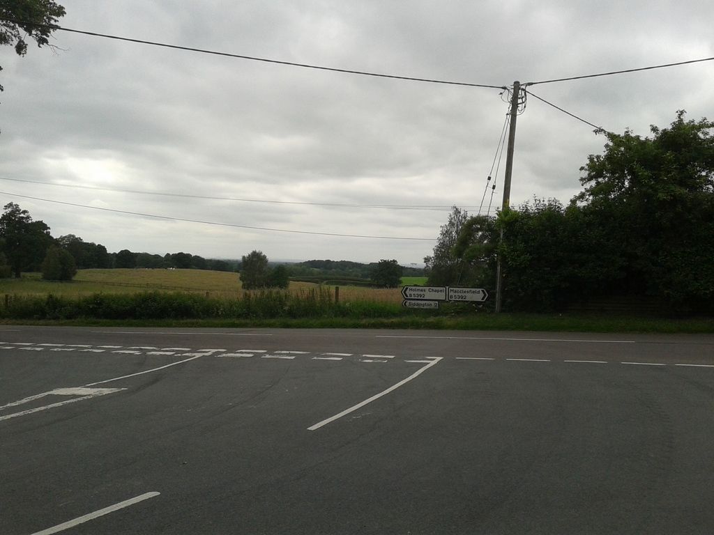
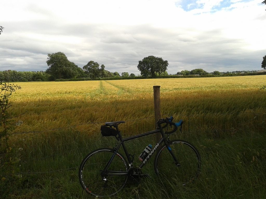
The road towards Ilam with sheep everywhere.
RcT048d.jpg


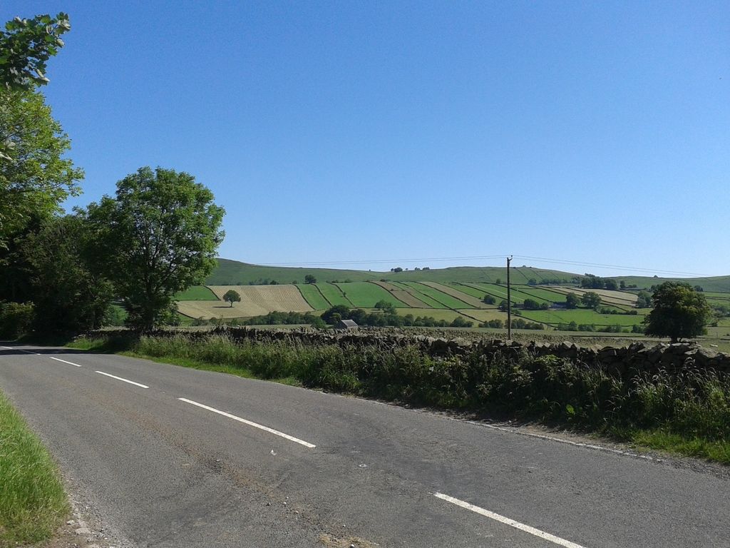
Once you drop into Ilam it's a big climb out whichever way you go. This is from the same place looking at where I'm going to go. Ilam is at the bottom but you can just make the road out on the opposite side of the valley following the tree line towards the left then going right and it emerges from the clump of trees on the sky line in the middle of the photo.
f17wxDD.jpg


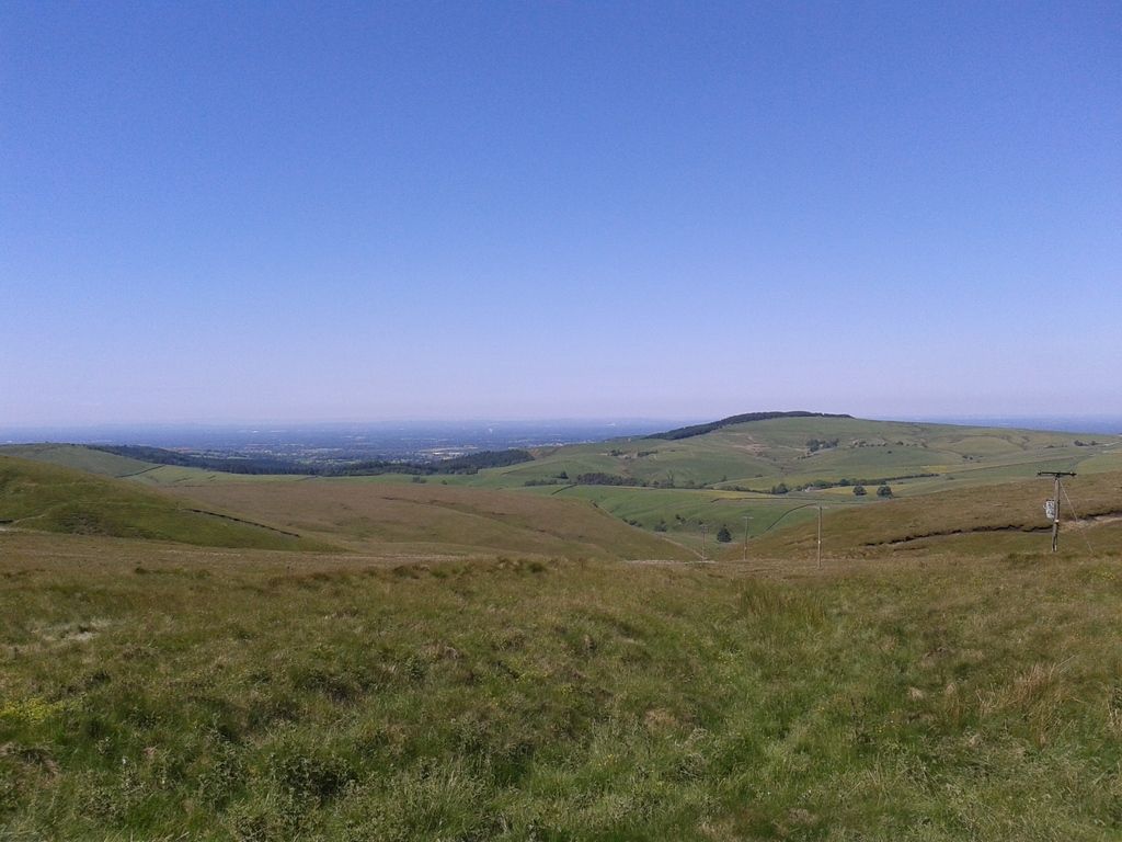
This is taken from the other side of the valley almost at the top.
rijx0fw.jpg


The Garmin (there's a reflection on the screen 🙄) but Strava has lost 0.1 mile but average speed is the same on both
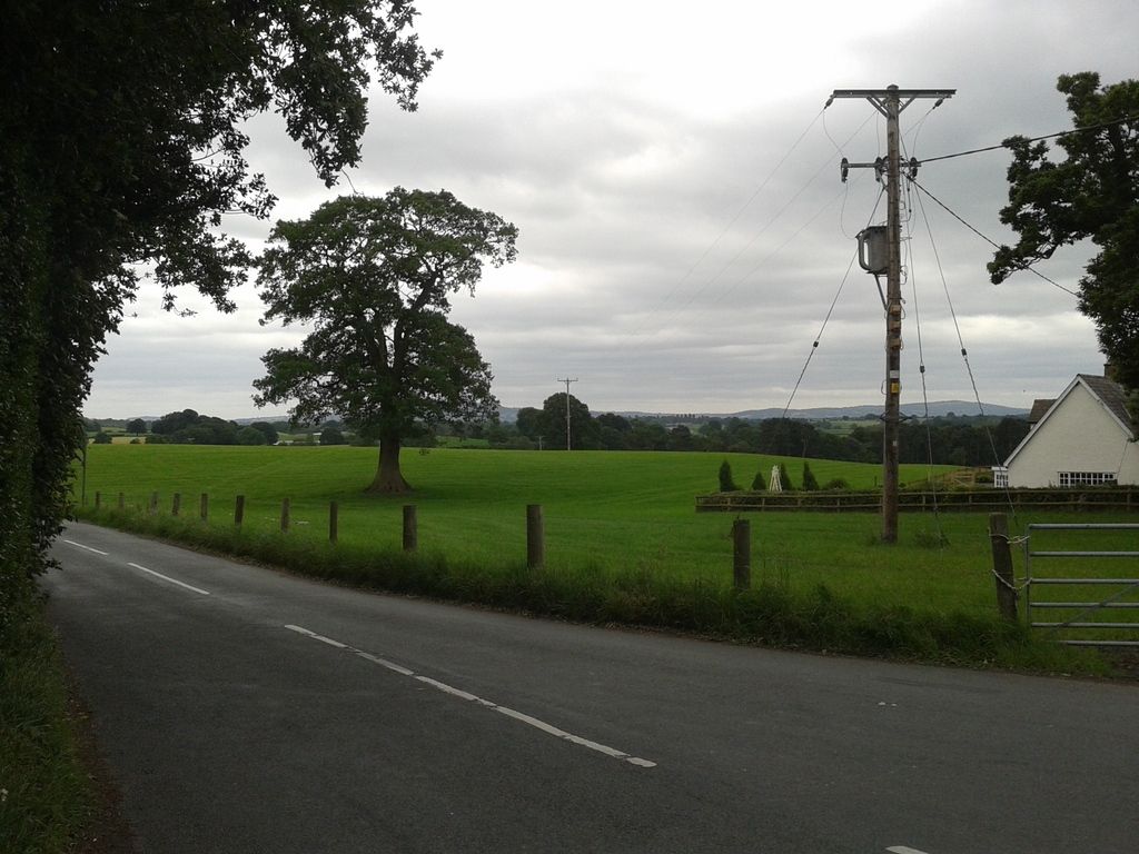
uzDXZy0.jpg
 
You have to look out for them white woolie critters Matt. :D:D

Ha yes. The road splits the fields either side (there are no fences) and they just wander about. Luckily none on the road today :D although most cars take it steady anyway as it's quite steep.
 
The forecasters got it spot on today as it was drizzly this morning so I had to wait until later this afternoon before the sun came out and it dried up and I could go out for a spin. Very pleasant conditions. I didn't feel 100% on this ride - one of the Cycle household has a bad cold so I hope it's nothing to do with that. I headed to Knutsford before looping back.

Strava stats are 61.8 miles completed at an average speed of 15.4mph and elevation gain of just over 2400 feet.

Levels are blood as I haven't got a Libre sensor on at the moment (can't afford one :(). At start 7.8 mmol/l, at 11 miles 9.0 mmol/l, at 18 miles 7.3 mmol/l, at 29 miles 4.3 mmol/l, at 38 miles 7.1 mmol/l, at 44 miles 5.9 mmol/l, at 52 miles 7.6 mmol/l, at 57 miles 9.5 mmol/l and back home 8.2 mmol/l. Fully expecting it to drop though. Have reduced evening Levemir so we'll see what happens. On the ride I had energy/protein bar, malt loaf and 2 gels.

I've reinstated all the earlier photos on this thread (took me ages 🙄) after the photobucket fiasco but you'll need to log in to view them full size. So anyone who wants to view them just register and join the gang!

Update on maize watch at Goostrey (I took a detour just for this 😉) - in 2 weeks with rain and sunshine massive growth. Either that or it's genetically modified.
qgmQU2D.jpg


Can definitely see the telescope in the distance today - horizontal. Nice cloud formations.
wXtJ0Kp.jpg


This is near Rudyard
pvoIfaL.jpg


The Garmin GPS device (yep it's a Samsung phone :D)
qwESkgU.jpg
 
Just catching up with these, I've been away. Impressive as always. Went riding for the first time in three weeks, the maize field we pass on the way is a similar height! Was much smaller before I went on my hols.
 
A bit of rain this morning so I waited for it to dry out. I'm still not feeling 100% and it's the final stage of TdF as well (it's a late start for the ride into Paris - just finished and a stage win for Dylan Groenewegen but well done Chris Froome on the GC and fourth win!) but rather than sit on my arse in front of the telly I headed out into the Derbyshire hills to Monyash, Buxton and over the Cat and Fiddle - a ride wins every time. :D It threatened rain but was a mixture of cloud, sun and overall not too bad weatherwise.

Strava stats are 57.3 miles completed at an average speed of 14.1mph and elevation gain of a not unexpected (just over) 4300 feet.

Levels are still all blood as no Libre at the moment. At start 8.2 mmol/l, at 12 miles 9.6 mmol/l, at 21 miles 7.0 mmol/l, at 28 miles 5.1 mmol/l, at at 38 miles 4.8 mmol/l, at 45 miles 7.6 mmol/l, at 54 miles 6.4 mmol/l and back home 5.3 mmol/l. On this ride I had 2 gels, half an energy/protein bar and a protein cereal bar (some new effort from Aldi around 15g CHO) with quinoa and coconut - quite nice.

This is near a place called Flagg not far from Monyash, Derbyshire limestone drystone walls and cows queuing up on the left - must be milking time!
GFfuIBn.jpg


This is on the Cat and Fiddle road on the way down looking towards the Goyt Valley
Gb0diPf.jpg


Here's the Garmin
BIrgG5B.jpg
 
We will have to change your user name to STING. All these pics of "Fields of Barley". Really good Matt. 😎😎
 
Status
Not open for further replies.
Back
Top